Friday, January 6, 2012

Back Door to Cannon

Monday January 2 2012

    It was a nice day for the first hike of 2012. It was almost too warm for a winter hike. I drove across town to pick up Chris and Moses the hiking dog. It was 44° in town as we left at 6:15. We figured it would be about 20 degrees colder on the mountain. As I drove the two hours to Franconia Notch I was wondering how I’d do today. It’s been over two months since I hiked because of a surgery in late October and then the Holidays and two mandatory overtime Saturdays. I was concerned too, about the hip belt from my pack irritating the site of the incision. Turned out, as usual, I was worried about nothing. There is a trail that goes up the same side of Cannon as the ski slopes but though it is shorter, it is very steep so we elected to take the long way up the back side.
    We got to the Lafayette Place parking lot around 8:15 and were on the trail a few minutes later.


Lonesome Lake Trail goes from the campground to the Kinsman Ridge Trail. The trail first climbs a ridge for a few hundred feet of elevation gain and then drops down to a trail junction on the East shore of Lonesome Lake.
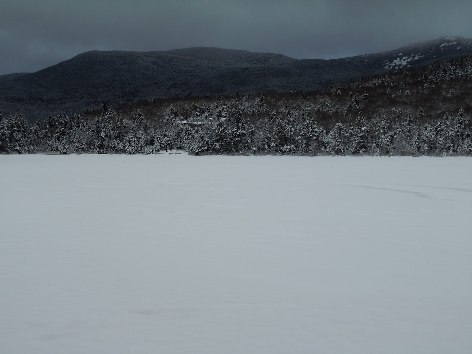

 We took a short break for snacks and photos. Taking  the left for four tenths of a mile leads you to Lonesome Lake hut which can be seen from the East shore and is open year round. The right, which we took, is a continuation of the Lonesome Lake Trail. It skirts the northeast side of the lake on a series of bog bridges then veers North to ascend the Kinsman Ridge at a moderate rate. The trail joins the Kinsman Ridge Trail on the  saddle between Cannon and Northwest Cannonball.


It follows the saddle along and then ascends Cannon steeply on the West side. There are several places where a slip could result in a nasty fall but nothing death defying. Moses, as usual negotiated everything with ease. One area of boulders we went through were covered with ice that froze in some unusual patterns on the undersides.

  Once on the upper ridge the grade moderates and for the next half mile it’s a pleasant walk in the woods.

Just before the summit, we stopped to add some warm layers to fight the cold wind we’d experience on the tower platform.  My new down parka kept me very warm.
    As I said, there is  platform on top of Cannon. Four set of stairs lead you up to a large observation platform. Everything at this elevation is covered in rime ice. The views from there are very nice.

Some clouds obscured Lafayette and Mount Washington but pretty much everything else was in view. After a round of photos, we headed down to a more sheltered place to have lunch. We spoke to several groups going to and from the summit. There are several hiking trails and a couple of ski lifts that provide access to the summit. We saw probably 30 people on the trail today, an indication of how popular hiking in the Whites has become. We headed back down the trail and within a couple of hours we were back at the parking lot. Another wonderful day in the mountains of New England.


Tips and hints

 Layer and body heat management

Controlling your  body temperature in winter is essential to being safe. Everyone's inner furnace runs a bit differently so it is important to find out what works best for you. On a twenty degree day I see everything from people who put on all their insulating layers in the parking lot and keep them on all day, to people who, as I often do, putting on  light layers in the parking lot and then removing them in 15 or twenty minutes after the furnace really fires up.

My layers in winter consist of ; A poly-pro liner sock and a pair of medium weight wool socks. Poly-pro long johns top and bottom. A pair of nylon hiking shorts (for the pockets and modesty). A pair of Gore-tex gaiters. A medium weight zip neck pullover of wool or poly-pro. A light pair of wool gloves. This is what I wear in temps down to 15 or 20 degrees if there is not much wind. In temps below that I'll add a light fleece zip pullover. When above treeline or for longish breaks I'll put on Gore-Tex pants and hooded jacket. In severe cold and wind I also put on a hooded down parka, a balaklava and Gore-Tex over-mitts. I also carry but have never worn, a pair of fleece pants for extra insulation. I also have a neoprene face mask and goggles that I wear in severe conditions.

 Gear management takes practice. In very cold windy conditions, you need to be quick about getting on extra layers so your core temp doesn't drop too much. A balky zipper or buckle, when it's relatively warm is a pain but in severe conditions it is dangerous. Getting used to getting clothing as well as traction devices out of your pack and getting them on as quickly as possible is an essential skill in winter conditions. I try to familiarize myself with any new piece of gear before I need to use it on the mountain.

Sunday, October 23, 2011

No Danger on the Tripyramids.

Sunday October 16 2011,

    Went for a fall hike in the White Mountains against the advice of a store clerk I spoke with yesterday at Ragged Mountain Sports in North Conway, New Hampshire.  I’m not too sure why people are so free with advice or why most of it is so bad. I mentioned to him in conversation that I was going to climb the Tripyramids today and he warned me against it. The rivers are all at flood stage, he said. There are a lot of brook crossings, he said. There’s apt to be ice on the ledges up high, he said. The winds on Mount Washington are forecast to be 70 - 80 MPH and there is a long ridge-walk, he said. His sage advice unheeded, I went anyway.  Neither I nor my hiking partner Chris or Moses the hiking dog or any of the thirty or so other people we saw suffered any ill effects as far as I could tell.
     I looked at a map and saw that the brooks we had to cross were on moderately  steep terrain and knew that the water would have come down since the heavy rains on Friday.  I also knew that the conditions on Mount Washington would be greatly diminished  by lower elevation and shelter of trees on this hike. I asked Chris about the stream crossings since he had climbed these mountains  twice before. He couldn’t remember any tough crossings. If you do your homework before a hike, go prepared for the worst conditions you are likely to encounter and rely on your own experience and that of experienced hikers who know you and your abilities you will have a safe and enjoyable hike.  Chris and I could have and would have done this hike in any but the most extreme conditions. Torrential rains with the threat of flash floods or a blinding snowstorm might dissuade us but not much else.  The lesson here for me is, if you are going to be dispensing advice to hikers, you might at least find out what their skill level is first and if it surpasses yours, keep your advice to yourself or ask for some pointers.


Hiking sticks at the trailhead.
    Now on to the hike. I picked Chris and Moses up at 6:30 and headed for New Hampshire.  We were both looking forward to doing a big hike. North and Middle Tripyramid are to the Southeast of the Kancamagus Highway. There are several trails to their summits. We chose the Pine Bend Brook Trail.
One of many brook crossings
The trailhead is a gravel pullout with about enough room for two cars. When we got there at 8:00, there was only one other vehicle. We got ready to go and stepped off about 8:10.  We hiked up the little valley that contains the brook the trail is named for. It is pretty gradual for the first mile or two following and crossing the brook in several places. None of the crossings was difficult and we rock-hopped most of them, once crossing on a convenient log.  At the head of the valley, the trail crosses a last time and climbs steeply up to a ridge.
Recent rains made for many attractive waterfalls.

Me on the summit of North Tripyramid
We were halfway up the ridge when we heard voices down below and  kind of stepped up our pace a bit to stay ahead of them. I’m not sure what it is, pride, competitive drive or just foolishness but it bothers me when people pass me on the trail. We stopped a couple of times above a steep pitch to catch our breath and evidently the party below did as well because they never caught up to us.
    We made it to North Tripyramid by 11:00 and took the obligatory summit photos. Since there are trees surrounding the summit, the views are spotty at best. We soon set off to Middle Tripyramid and met the occupant of the car that we saw at the road and talked to him for a few minutes. He was from Londonderry NH and had started about 40 minutes ahead of us. Continuing on, we met a woman with a dog who had come up from the Tripoli road and soon after, a couple of guys who had come up the Sabbaday Falls trail.
Middle Tripyramid

View South. Passaconaway in the foreground Chocorua and the Sister in the middle background.


We made it to the top by noon and immediately dropped our packs and dug into them looking for food. There were nice views to the North and South from ledges. Views East and West were obscured by trees. Soon the group of people behind us caught up and Chris knew one of the women who was from Bethel. We had a leisurely lunch and chatted with this friendly group of four.
    Soon it was time to head down and we all began together. I had a nice talk with the gentleman of the group. We started meeting more hikers headed across the saddle between the two peaks and after crossing the North peak there were even more and we were steeping aside to wait for people to pass every few minutes.
A huge glacial erratic along the trail.


We met probably thirty people, the last of whom we wondered if they would have time to summit and get down before dark. We got back to the road about 4:00. At this time of year it gets dark around six so I was glad of our early start. As usual, a great day out in the mountains of New Hampshire.

Thursday, September 15, 2011

Flags on the 48, on Wildcat D

September 11, 2011

    An awesome hike today with Chris and Moses the hiking dog. It’s been a while since I have done a strenuous hike or climbed a 4000 footer. My purpose in hiking today specifically was to be on a summit for Flags On the 48. Flags on the 48 is a ceremony to memorialize the victims of 9/11. An American flag is flown on each of the 48 mountains in New Hampshire that are over 4000 feet in elevation. People sign up every year for it and I have wanted to participate but the timing was never right. Today was my chance and since it is the tenth anniversary it seemed appropriate.
    I picked up Chris and Moses at 6:45 and we headed off.  On the drive down Rt. 16 we noticed a cool cloud formation over the Southern Presidential range an stopped for photos.


Wildcat D is, as you look up the ski slopes at Wildcat ski area, slightly  to the left of the top station for the gondola. We were  concerned, the trails would be washed out or have multitudes of blowdowns to deal with in the wake of Irene. Other than some evidence of minor erosion, there were no problems, at least on this trail.
    The Wildcat Ridge trial begins on route 16 at the Glen Ellis Falls Parking lot and ascends the end of the ridge to Wildcat E and then traverses across the ridge up and down through a series of saddles to D,C, B and finally Wildcat A, another 4000 footer. The trail then descends to Carter Notch to join the Nineteen Mile Brook Trail. We decided to Park at Pinkham Notch Visitor Center to avoid having to ford the Ellis River. After parking, we got our packs together and soon headed out. We crossed Route 16 to pick up the Lost Pond Trail which would take us to the Wildcat Ridge Trail.


It first crosses the Ellis River on a footbridge and then follows downstream for a half mile, passing several inviting pools that beg to be fished or waded in. The trail skirts the East shore of Lost pond.
Ledges and large boulders surround this pretty little pond. Soon we drop down to the end of the trail and turn left onto the Ridge trail and begin to climb …and climb…and climb.
    As you climb the steep trail to gain access to the ridge the rewards are quick to come.
Open ledges appear every few hundred yards with opportunities for good views and a rest. Although progress is slow, you gain elevation quickly. As we climbed, a couple of groups overtook and passed us. We were comfortable with our pace as the hike was under six miles. We only need to be on top in time for the raising of the flag which was to occur at noon.

 The day was clear and the views were getting more spectacular as we gained elevation. Glen Boulder, Slide Peak and Boote Spur were the first to show then Mounts Washington, Madison and Adams came into view.
The large glacial bowls of Tuckerman and Huntington Ravines were very impressive from our vantage point. After the last open ledges. The terrain flattened out for a bit and then started to climb again to the top of Wildcat E and then dropped into the shallow saddle between E and D. As we were going across, we began hearing an odd noise like a warning noise or alert beeper. I thought it was someone’s cell phone.
It turned out to be the Gondola which unloads within yards of the trail. I read in the trail guide that it did but wasn’t prepared for all the people and the large terminal building. We passed through quickly and began the final climb to Wildcat D. We were passed by a man who had a length of PVC pipe attached to his pack. He was the first of the group of  Boy Scouts of troop 91 from Manchester New Hampshire who were flying the flag for Flags on the Forty-Eight.
    There is a raised platform at the summit which is above the trees so there are good views from a mountain which would otherwise be viewless. We sat and ate our lunch as more of the scouts arrived and readied themselves to raise the flag. in ones and twos, the final sections of the PVC flagpole arrived on the backs of Boy Scouts. There were six four foot sections of 1 ½  inch pipe which slid into 2 inch pipe and were duct taped in place. Six guy lines were attached and tied to the railings to stabilize the pole. A pulley and lanyards secured the flag in the usual manner. The scouts and their leaders worked together to assemble everything in time to raise the flag at noon.
In due time the flag was in place and a short ceremony followed, with the Pledge of Allegiance being said and a moment of silence for the victims of 9/11. I forgot to bring binoculars on this hike but others who had them reported being able to see flags on some of the other peaks.

We hung around for a few more minutes and headed down. The hike down was, due to the steepness, nearly as hard as the climb up. Moses the hiking dog amazed me with his agility, bounding down the steep, rocky trail like a ball in a pinball machine. Head down, tail up, he seemed to be enjoying himself. The views caused us to pause at every open ledge and snap a few more photos.

We got back to Pinkham about 3:00 and headed home.  Wildcat D was my  36th 4000 footer. I have 12 left. I’m hoping to finish in the next year.

Thursday, August 25, 2011

Now, Where Did I Put That List?

Saturday August 20 2011

    I had planned a couple of weeks ago to hike with Chris this weekend. When he called Thursday evening, I said I had too much to do around the house but after thinking it over I called him back and said I’d go. I’m very glad I did. An acquaintance of his, Marilyn, is working on the hundred highest list which is to say a list of the one hundred highest mountains in New England. There is a group of mountains in Northern Oxford and Franklin counties called “The Six Pack” They are on the list and two of them were our objective today.
    I picked up Chris and Moses the hiking dog at his place at a little after 7:00 and we drove to Bethel to Pick up Marilyn. We left there a bit after 8:00. The drive to the trail is pretty, going up Rt. 2 to Mexico and Rt 17 to Oquossoc and South on Rt. 16 a few miles to Morton‘s Cutoff.  At the Height of Land the view over Moosleukmeguntic there was a beautiful  with a fog rising off the lake forming a cool undercast. There was no time to stop and enjoy the view, we were still nearly an hour from our destination.  From Rt. 16 there is a network of logging roads twenty miles to the start of the trail. We arrived there a bit before 10:30. We got our gear together and headed up the trail.    


    White Cap and North Kennebago Divide are billed in the guide books as bush whacks but there are pretty well defined trails to the top of both of them. Ten years or so ago they would have been infinitely more challenging than they are today. Not knowing  this however we were prepared for battle. I printed off topographic maps for all of us and entered waypoints for the summits and some key landmarks along the way. The trail we were on was an extension of the logging road we were parked on but was impassable for conventional vehicles. ATVs had been traveling along it though so the going was good. We decided to climb White Cap first and as we walked along we came to a cairn marking a trail to the Southwest and we hoped to North Kennebago. We’d find out on the way back. We had started our hike at around 2700 feet. The summit was 3800 feet. As we climbed  we talked about the flora and fauna in the area, noticing piles of bear and moose droppings and areas that had been browsed by moose. We saw moose and fox tracks in the mud in a wet area.
    We got to the col at about 3400 feet and were keeping an eye out for a trail to the right that would lead to the summit. The ATV trail however swung to the right and we continued to follow as long as it was gaining elevation and heading in the right direction.


A few minutes later we came to a cairn and a trail to the left which we followed. We were close now and had only to find the highest ground and the summit canister that held the register. Less than a hundred yards off the ATV track and right beside the trail we were following, there was a clearing with a burned out solar panel attached to a tree. A wire wound up the tree and out of sight. I have no idea what purpose it served. Could it have powered communications for the Border Patrol? The Canada, U.S. border was a mile or so away and this might be the nearest high ground. It remains a mystery. Anyway, we continued along the sometimes faint but always present trail toward higher ground until we pushed through a thicket and emerged in a clearing where the canister was attached to a tree along with a sign “White Cap”


We congratulated Marilyn, this was her 92nd peak . Since it was “high noon” we had a lunch, took some photos and signed the register. Signing was a chore since the contents of the canister were somewhat soggy.
    We soon headed off down the mountain and toward our second peak, North Kennebago. When we got to the cairn at the lower trail junction we headed off. Within a few minutes it was clear that this was not going to be as easy as White Cap. There were herd paths going everywhere. We tried to stay with the most prevalent one but it was hard to distinguish. Soon we were back up on the col and moving toward the trail up White Cap, clearly not where we needed to go. I was looking around but could not see higher ground in any direction.


We decided it was time to stop and regroup, get out a map and compass and take a bearing. I knew more or less where we were and after orienting the map, got a bearing on the direction we needed to go. As we set off again we immediately came across a trail that led in the right direction and we started gaining elevation. Hooray!


The trail was more or less clear all the way to the top. The canister was a glass jar tied to a tree and we again signed the register. Marilyn’s 93rd peak was now In the books.


    The trip down was uneventful with the exception of a branch  the snapped back and hit Marilyn in the face, very near her eye. It was a close call for an eye injury and we were sobered by that. We slowed down and put more distance between us to avoid a repeat.  We were back at the trailhead at 3:30. We had hiked a total of five miles. We all agreed that it had been a very enjoyable and successful hike.

Thursday, August 4, 2011

Five Plus Two Equals Chocorua

July 31 2011

Five on two legs and two on four. Seven souls set of to climb Mount Chocorua near Conway New Hampshire today. Beth and I have been talking about hiking together for quite some time. Today we got the chance. I picked up Beth, her daughter Jill and their two dogs Buffy and Bu at Green Pond. They were all set to go and we headed to Sean’s to meet him and daughter Leah. This was to be Leah’s first “big mountain”. A precocious five year old, Leah’s hiking limits were as yet untested on a mountain of this size. Sean decided to take his own car in case they were not able to go the whole way. We left their house about 6:45 and drove to the Champney Falls hiker parking lot on the Kancamagus Highway arriving there about 7:45. Donning hikers and disbursing water, within a few minutes we were off. The weather was clear and with temps in the mid sixties, it was shaping up to be a perfect day.

 Leah was eager to go and to interact with the dogs.
After a quick photo at the kiosk, we headed up the trail The first mile was a shakedown of sorts with everyone trying to find a comfortable pace. Leah preferred to be in the thick of things and with the dogs but since Jill had both dogs on an Alpha lead and they were beside her, that meant four abreast and on a narrowing trail that was not going to work. Sean eventually convinced Leah, she should lead and set the pace. She was good with that and we settled in to a nice leisurely pace. Soon enough we were at the lower junction with the loop trail that goes by Champney and Pitcher Falls. We decided to go by the falls on the way up and  bypass them on the way down.

We got to the lower falls and stopped for a quick break and to take some  photos. A long stretch of dry weather had reduced the flow of water to a trickle but it’s a pretty place anyway. In winter this is a popular ice climbing spot, not much ice around today. We headed up the steep trail that skirts the lower falls and leads to the upper. At the upper falls we waited for a group of faster hikers to pass before continuing on. The next mile and a half seems longer than it is. There is only one good view spot and the trail gets steeper and more rocky than the section below. There are several switchbacks in this section and once past these the Champney Falls Cutoff diverges left and leads to the Middle Sister Trail. The grade soon eases as the trail nears the saddle between Chocorua and Middle Sister. From the more open ledges we began to catch glimpses of our objective.
Soon we passed the Piper Trail on the left and then the West Side Trail on the left a short time later. The last .4 mile is entirely in the open and view get better every minute. We climbed up and over the minor peak North of the actual summit and during this time were passed by several faster moving groups. At last we arrived at the crux move just below the summit, a head high section of ledge the dogs couldn’t negotiate. We could have lifted Buffy but Bu at 100 lbs. was a different story. Beth stayed behind in a shady spot with them as the rest of us scrambled up and over.


Leah had done an awesome job all day and with a bit of guidance from dad clambered up to the top. Sean and Jill topped out and enjoyed the views we worked so hard for. Having been here more than a half dozen times before, I headed down to relieve Beth so she could go up. Ten minutes or so later, the summit team came down and we all headed to a lower flat spot for a well deserved lunch. It was a nearly cloudless day and we enjoyed the
endless views. Twenty-two miles to the North,  Mount Washington was clear enough the we could see the summit buildings.


We finished our lunch and headed back across the ledges and down into the woods now meeting groups of hikers on their way up. We took our time going down with Jill and the dogs in the lead and Sean and Leah bringing up the rear.


We made our way down the mountain with several stops to let little tired legs catch up. We got back to the parking lot a little before 2:00 and took a long break on the grass, in the shade. Sean provided a cooler full of cold drinks and fruit. A nice end to a wonderful day in the mountains.