Tuesday, March 22, 2011

Sunday River Whitecap


March 20 2011
   
    A little known and seldom visited mountain in Western Maine, turns out to be one of my all time favorites. Until five years ago, there wasn’t even a trail to the summit. Sunday River Whitecap is a mountain, just South  of Grafton Notch on the West side of route 26.

I had heard about people bushwhacking to the summit at least twenty years ago. It has been on my “most wanted” list since then. It wasn’t until five years ago that I stood on it’s summit and enjoyed the awesome views. At  3,400 feet, it’s not a big mountain but it’s extensive area above treeline, the effort it requires to get there and the  panoramic views, give that feel.
    The Grafton Loop trail came into existence due to the incredible efforts of a group of people in the Bethel, Maine area.   The Grafton Loop Trail Coalition is a consortium of several organizations and many individuals who’s efforts created a 38 mile loop trail that begins and ends on the Appalachian Trail. One end on Old Speck, the other on East Baldpate. To Get to Sunday River Whitecap you either hike from the South from Route 26 for 7.1 miles or from the North 13.5 miles over Old Speck. I did the latter as part of a backpack five years ago. My favorite way is to do a bushwhack. I have done this twice before but I wanted to do it in the Winter.
    Since today was the last day of winter and  I was going to hike anyway, I decided to cross this one off the list. In summer I drive up the Quonset Hut road, take the left and go to the last landing and start there.  In Winter, the road is a snowmobile trail. I parked at the end where there is space plowed for a few vehicles. I started hiking about 8:30. On the snowmobile trail I was able to go without traction devices and moved along quickly. I followed the trail to the last landing and was trying to decide what line to use going up to Miles Notch. I noticed that someone had tried to drive a snowmobile up a skidder trail in the direction I wanted to go. I say tried because it did not go well. In the couple hundred yards he made it, he got stuck three times. I was spared having to put five pounds of snowshoes on my feet for that distance so it was all good.
    I put on the snowshoes and headed uphill toward Miles Notch and my eventual connection with the Grafton Loop Trail. Due to recent rain and warm temps and then a hard freeze, the snow was crusty enough to hold my weight much of the time but earlier testing convinced me to keep them on. A light dusting of snow revealed an array of animal tracks. Coyote and Fisher on the hunt. Squirrel, Partridge and Rabbits looking for a meal too. I expected to see moose tracks but the only evidence I saw was last years rubs on a few small trees.


  I added a waypoint to the GPS at the height of land in Miles Notch and headed toward it going a bit further North than last time I was here. Once I was near the wayppoint I slowed down and started to look for signs of the trail. Soon enough, I made out a very faint snowshoe track and looking in the direction I knew I needed to go, I saw the first blue blaze indicating I was on the trail.

 Heading off toward My destination following as best I could. Once I lost the trail for a few minutes but soon regained it. In about ten more minutes I reached the first viewpoint, an East facing ledge with views of  the Baldpates.


I continued upward and was soon on the open ledges with views in all direction. The wind packed crust seemed to be more solid here so I took off the snowshoes and donned micro-spikes for the rest of  my stay above treeline. I love the feeling of being above the trees, in the open, with views that go on forever.


I stopped and took pictures whenever a view struck me. By 11:00 I was standing on the summit enjoying 360 degree views in complete solitude. I spent twenty minutes there soaking in the views, having lunch and taking a few more photos. I stowed everything in my pack and headed back down. It always amazes me how much faster the return trip is. In ten minutes I was back down in the woods and switched back to snowshoes for the duration.
    Each time I have done the bushwhack I have been looking for a flagged trail, rumored to exist up through the cut over area that is a minefield of blackberry bushes and slash from last time it was cut. I had given up the idea that it existed . I added a waypoint on the road in a straight line from the edge of the saddle to a place near where the road, now snowmobile trail, takes a sharp right toward route 26. As I made my way down I began to notice orange flagging on the trees to my left. I wandered over that way and saw the same faint snowshoe trail I had followed up above. I was on the fabled, flagged trail. I followed it down to the road.
    As I approached the road I noticed someone walking along it. He appeared to be waiting for me. As I stepped into the road he said, “I’ve been following you.”  Evidently he had tried to do the same hike but was stopped because he hadn’t carried his snow shoes and as I said before, the crust would “almost” hold you up. I took off my snowshoes and talked to the guy for a few minutes and then we headed down to the end of the road where we were both parked.  We talked for a few more minutes and went on our way.
     I love the Grafton Notch area. I have been riding or driving through the notch since I was a baby and coming here always feels like coming home. I have explored and hunted and fished all around the area for decades and I enjoy it more each time.                                                                                                                                                                                       

Sunday, February 20, 2011

Full Moon Madness

February, 18 - 19 2011


    I have been looking forward to doing this backpack for a long time. I managed to combine three of my favorite hiking categories, moonlight hikes, hikes to fire towers and backpacking. Kearsarge North, just outside North Conway, New Hampshire is ideally suited to this combination. The trail is only three miles, it is not technically difficult and there is a fire tower at the top that is both open and big enough to sleep in.
    I talked to Chris, who often hikes with me and he was onboard. This would be my fourth trip up the mountain, my second in winter so I felt familiar enough with the trail to try it at night. Due to it’s proximity to North Conway and the relative ease of the trail and the very attractive, accessible fire tower at the top we felt the trail would be well packed.
    We got to the trail head parking lot about 5:00 and discovered one car with NH plates parked there.


We got our boots and gaiters on and after a couple of pictures at the sign, we headed off.  Since sunset is about 5:15 we still had nearly 45 minutes of light left but we kept the headlamps near at hand. I knew the 18th was date of the full moon but I was not sure of the time it would rise or what the cloud cover would be. We were both prepared for full dark with two headlamps apiece and extra batteries. As the sun went down and night settled in Chris turned on his headlamp and I, as long as I stayed close, was able to see well enough without. 


    Since the trail is so accessible, many people use it and many do not use snowshoes. Today’s temperatures warmed up the snow and softened the trail to the point that with heavy packs, we needed snowshoes. Many people who did not use snow shoes, chopped up the trail to the point that it was uneven and hard to walk on in places. We made our way up the trail to the point where it makes a left turn to the lower ledges. I saw what I thought was a headlamp coming down toward us.  We got to where I thought I’d seen it and Moses the Hiking dog, looking off trail, started growling and barking. I started looking around and saw fresh deer tracks headed off in the direction he was looking. I realized, what I had seen was these deer, several of them, between us and the rising moon giving the illusion of a moving light. I bet we gave them a surprise! We continued up the trail to the beginning of the lower ledges and started to get some views of Mount Cranmore, lit up for night skiing. The lights of North Conway were soon in view as well.


As we hiked along the moon rose to fully illuminate the ledges and we were able to see without lights for a few of the more open stretches.
    After the ledges, the trail ducks back into the woods on the Northwest side of the mountain and climbs gradually to the ridge which connects it with Bartlett Mountain to the West. Since the Moon was on the East side, we both used headlamps for this section. Soon enough we were on the last push to the summit, the fire tower and dinner. Since it was nearly 9:00 food was on my mind and long overdue. I turned off my headlamp and negotiated the last several hundred feet to the top in full, magnificent moonlight. I threw down my pack and removed my snowshoes. Grabbing up my pack, I headed up the stairs to the Tower cab. As I gained the deck I realized, there was someone there ahead of us.
     A couple from southern New Hampshire had set up a small tent inside the fire tower, really not sure why unless for privacy.  We set up both stoves, Chris to heat water for drinks and me to cook dinner. On the menu was Parmesan Noodles with Chicken.

I had cooked the chicken at home so all I had to do was cook the noodles for 5 minutes and adding the chicken at the end to heat it through. I let it sit for a few minutes to thicken the sauce and we dove in. I think I could have eaten the whole thing myself but split it with Chris and then ate a bagel which I’d intended to munch on, on the ride over. We also had a dessert of Summit Bars, Chris had made the day before. We melted some snow to have water ready in the morning.


    The wind which had been steadily rising all evening had reached a fairly steady 30 miles per hour with gusts at 40-45. I made a couple of trips outside to walk around the deck and enjoy the full moon views. The whole landscape was lit up and with the snow reflecting it made the lakes stand out and the Presidential Range was bathed in light, standing out in remarkable detail. I wished for a camera capable of capturing the awesome sight. My attempts were woefully inadequate. On the windward side, I had to hold on to the railing to keep from being blown around. Winds were below the velocity required to
knock you down but walking was akin to being a drunken sailor. Inside, we laid out our sleeping pads and bags and made ready for the night. We crawled in our bags and I thought I’d sleep well since I had been up since 4:30 AM and it was now 11:00 PM. Sleep was slow to come though. The wind seemed to ratchet up a notch and now besides that sound there was a rhythmic  thumping as some of the underpinning of the tower flexed in the wind. There are four very stout cables that anchor the building to the ground and there were points where I doubted their ability to do the job. With each strong gust, you could feel the tower move a bit as it strained against it’s earthly tethers. I may have dozed a bit but found no sleep until the wee hours. I heard the couple stirring, getting up to go out and do their business. Chris got up to do the same and I decided I might as well make it unanimous. I discovered then that the woman was smoker and when she didn’t come back in with her husband, I looked out to see her standing in that crazy wind having a smoke! Such is the strength of nicotine addiction. I pulled on my puffy down jacket and a knit hat, gloves and down booties and made my way out into the still howling wind. To my surprise it really wasn’t that cold, perhaps 25 degrees but the wind was biting. I hurried through my chore and climbed back up the stairs and into the  tower. After that the wind subsided a bit or exhaustion took over because I finally got to sleep.
    When I woke up it was full daylight, about 6:30.  Within a few minutes everyone was stirring and we got on with the business of getting coffee water heating and breakfast started. Chris was the breakfast cook and was making pancakes. He made them from scratch and had actually carried an egg and a cup of milk to add to the mix.  The views this morning while not bad, were nothing like they were during the night. The Presidentials were socked in and in fact it had snowed a bit in the night.


We leisurely packed up, reflecting on how different it would have been to do it after having spent a night in a tent. The wind was still blow pretty hard. With a couple of parting photos we headed down the mountain.


Our hike down was uneventful. We met more than twenty people on their way up and couldn’t help noticing the wide range of appropriate gear or lack there-of. One guy had crampons on and an ice ax strapped to his pack. This was total overkill as there were no places where there was more ice than you could easily step over and no wind packed snow or exposure to a fall that would warrant this equipment. What he should have had but didn’t was snowshoes. Many people did not have snowshoes and the trail was bound to be more chewed up as a result. Then there was the couple who had no pack, no water, nothing. In summer, no problem. Fall and Spring, depends on the weather. Doing a three mile hike in winter requires a pack, period. Snacks, extra clothing, map, compass, water and a few other essentials should be in there. If you are immobilized for any time in winter, hypothermia will quickly become your enemy. A slip and fall with a badly sprained ankle, if there is no one else around can become life threatening.  There are volumes written about winter hiking. Read up people!
 

Monday, February 7, 2011

How Pleasant

February 6, 2011

Not my first choice for a hike today but given the conditions and time constraint,  I’ll take it.  Pleasant  is about thirty minutes away and when I need to get out but don’t have a lot of time, it is the place to go. Due to the snowfall last night, I had to clean out the yard this morning and clean out the mother-in -law’s yard this afternoon. I picked up Chris and Moses the hiking dog about 8:00 and headed over to Bridgton and on the way we decided to climb via the Fire Warden’s Trail since neither of us had hiked it before.


We got to the parking area and were pleased to find it plowed. We were the first ones there and in a few minutes were ready to go. As we took our first steps on trail we resigned ourselves to a very tough hike. The trail had not been broken out since before last Wednesday’s storm which meant that there was now a foot or so of powder with a half inch of crust on top. This is miserable to snow shoe in as you must lift your feet clear of the snow with each step or risk catching a toe and tripping. It’s like constantly climbing stairs but never getting to the top. Two and a half miles of this was going to be grueling. Luckily, the trail coincides with the snowmobile trail the whole way and within a few minutes we came to that and the going was much better.

That trail only had the 2-3 inches and crust from last night’s storm.  We hiked along at a moderate pace and were making pretty good time. After a half mile or so we were overtaken by a pair of snowmobiles. After they passed, the trail was packed down and much easier than before.
The Fire Warden’s Trail is 2.5 miles and gains about 1,500 feet in elevation. We were about three quarters of the way to the way to the top when we were overtaken by a couple from Haverhill Mass. They had a  dog with them and Moses enjoyed a romp with her. The pair of snow mobiles that passed us on the way up appeared on their way down. We were then passed by another group of people on snow mobiles going up. Soon we were at the trail junction with the Bald Peak Trail


and a few minutes later the summit


. We continued our conversation with the couple from Mass and took in the view. After they headed down, another couple from Naples Maine arrived after climbing Ledges Trail. We had a nice conversation with them as well. The three snow machines took off and were soon replaced by four more. After that a single skier came up having skinned up Ledges. He was still there when we left so I’m not sure where he went down. Back country skiing is something I’ve always thought I’d like to try but never have. We headed down after having spent nearly an hour on top. We got about a half mile when the four sledders came down and passed us by. A couple of minutes later we met an older couple on their way up. It turned out that Chris knew them from some AMC hikes he went on years ago.  We exchanged a few pleasantries and continued down.

I noticed pieces of wood screwed to trees that must have been for holding insulators for wire to communicate with the Fire Warden's cabin. For the rest of the hike we had the trail to ourselves and a short while later we were at the parking lot. Of the six trails on Pleasant Mountain, there is only one I have not done. Perhaps next time I’ll hike the McKay pasture trail. A nice day to be out and as a bonus, there wasn’t a long drive home at the end.

Tuesday, January 25, 2011

Was It Cold? Hale Yes!

Sunday, January 23, 2011

    My hike today was among the coldest I’ve done. -5˚ at the Rt. 302 parking lot and it stayed there all day. I picked Chris up shortly after 6:30 and we headed over to Twin Mountain New Hampshire. We saw a fox on the frozen Pleasant River just below the Rt. 2 bridge in West Bethel. I love to watch foxes, I’ve been lucky enough to have seen many over the years. This on was traveling, hunting for something to eat no doubt. I wish I’d been able to take a photo.
    We arrived a the parking lot a few minutes after 8:00. I have never used chemical toe warmers and only once used hand warmers but today I started off with toe warmers and was glad to have them. I later got out some hand warmers and they stayed in my gloves for the rest of the day. We were on the trail by 8:20. Zealand road, the usual access to Hale brook trail, is closed in winter. This meant a 2.8 mile walk to the intended trail. Fortunately the road was plowed for logging operations, for about 1.5 miles.
                                           

The remainder is the winter trail to Zealand Hut and the North end of the Pemigewasett Wilderness and so was well packed. We bare-booted the distance in an hour and twenty minutes.
                                           

We took a short break for a snack and to put on snowshoes. The 2.2 miles to Hale summit  is not long or steep by New England standards but adding 4.5 lbs of snowshoes to your feet slows you down.
    We had gone about half a mile when we were overtaken by a solo hiker who Chris recognized. It was a guy who has probably climbed these mountains more times than anyone, ever. There is a new fad among Peak-baggers who are not content to merely climb all the 4000 footers or all in winter or all in one year or season. The newest affliction is called “The Grid”. It is, climbing all the 4000 footers in every month of the year. That’s right, 48 mountains times 12 months or 576 mountains. This gentleman has finished his third round of “The Grid”, an incredible achievement.
    After a short chat, we continued. I said before, the additional weight of snowshoes slowed us down.


Having started the Hale Brook trail about 10:00, we were at the top a few minutes before 1:00. We met the other gentleman coming down a few minutes before we got there.


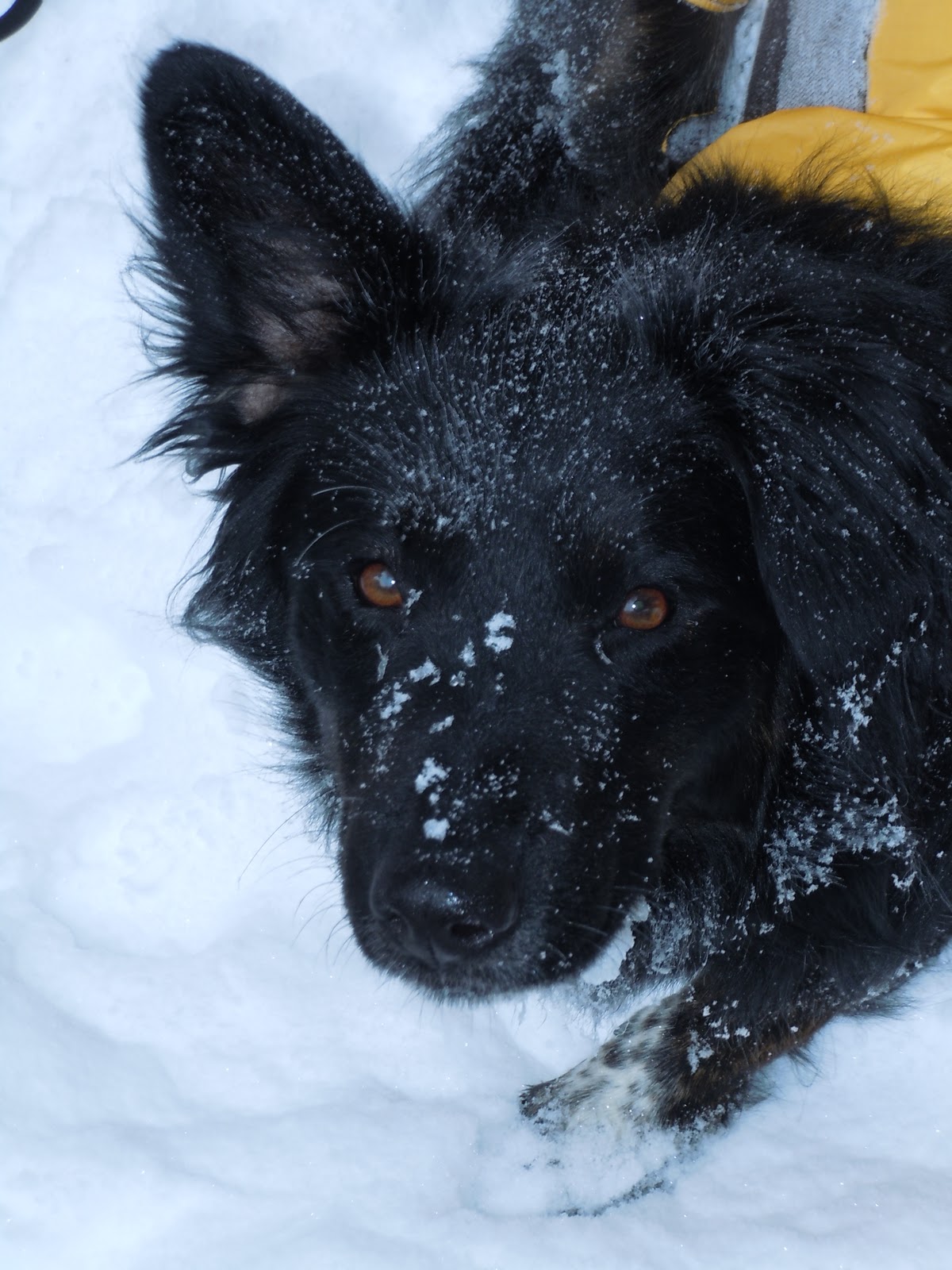
Moses the hiking dog had done well in the cold and had climbed his second winter 4000 footer.  Due to the cold, we only took a few photos and then headed down to a sheltered area to have a snack.
    To keep the blood flowing we headed down at a brisk pace  as we were working less going downhill. Chris also resorted to hand warmers at about this time. We got back to the road portion of our return and were overtaken by a couple cross country skiing. They had a dog with them and Moses enjoyed a romp with him for a few minutes. We got back to the parking lot at 3:20 and got home around Five.

Tips and Tricks:
             Hiking in cold weather poses some unique challenges. A little known phenomenon I've learned about is that when you eat something your body directs blood to your stomach to help with digestion. The result is, cold hands. This only becomes an issue for me when it is below 20 degrees or so. You have to learn your comfort zone and adjust accordingly. For me, at five below, that  means eating smaller amounts more often, using chemical hand warmers and planning to stop for shorter periods (If I keep moving, uphill or down, I usually won’t get cold).

Monday, January 10, 2011

Middle Carter

Saturday, January 8 2011

    I hiked with Chris and Moses the hiking dog today for the first time since doing Abraham last summer. Chris hadn’t hiked since mid November and would show the effects as we set off on our hike.  I picked them up at 7:30 and drove to the trail head.
    With the network of trails in the White Mountain National Forest there are often many ways to climb the same mountain. The choice we made was to go up and back on the South Branch of the Imp trail to the North Carter trail and Carter Moriah trail. Parking at the trailhead, we geared up and set off about 8:45. The elevation at the beginning is 1,270 feet and the summit of Middle Carter is 4,610 feet. With nearly 10 miles and 3,300 feet of elevation to gain,  this hike is as strenuous as some of the climbs across the road on the Presidential Range.  The temperature was around 15°, that would not change all day. This might seem cold but is actually pretty comfortable to hike in since you are working really hard. The trail skirts the edge of the Imp Brook valley and is wooded in it’s entirety. With no views, the only reason to stop was to chit chat, snack, drink and to catch one’s breath as the climb steepened.

We  gained the upper trail junction with North Carter trail at about 11:45 and after a short break and a couple of photos, we started off again.

The next 1.2 mile section is a bit of a slog. No views and a very steady, moderately steep grade, slowed our pace considerably. We met one other hiker just below the trails intersection with the Carter Moriah trail and spoke to him for a few minutes It was 1:00 when we gained the ridge.

With only .6 mi. to go we set off to gain the summit and finish the climb. At each ledge outlook we stopped to enjoy the hard earned views and snap a few more pictures.


Usually in winter, we would stop in a sheltered place below any possible exposure to the wind and add some layers of  clothing to protect against it. Today there was zero wind to deal with so we kept going. At 1:45 we were at the summit. There was no sign or apparent cairn so we had walked until there was no more up and called that the top.


After a quick snack, a couple more pictures and a congratulatory pat for Moses the hiker dog, (he had just climbed his first winter 4,000 footer) we began our descent. Micro-spikes made the snow covered trail easy to negotiate but our pace was still slower than usual.
     I plan my hikes with my average pace in mind, 1.3 MPH uphill and 2 MPH downhill. Since Chris has always been the stronger hiker, I figured we would be out by 4:00 or so. I Emailed Linda our hiking plans as I always do. I included my latest ETA to be home.  At 3:30 we were at  the upper trail junction and with 3.1 miles to go, I knew not only would we be late getting home but we would end our hike in the dark. This  was a first for me. Although I always carry a headlamp, I like to leave a margin of daylight in case something goes wrong.  We could still see the trail as we hiked the last half mile but only just. It was pretty much full dark when we got to the parking lot.   
    All in all a great day out and with a late return but no harm done. As with most of my hikes, I learned some things. First, don’t take for granted the person you hiked with is in the same physical shape he or she was in  the last time you hiked together if it’s been a while since you did so. Second, always pad your time a bit for trail chatter, especially if you are hiking with someone who stops when they talk! I have hiked alone so often lately that I’d forgotten to add in time just for interaction with another person.                                                                                                                                                                                                                                 

Tuesday, January 4, 2011

Mt. Whiteface and Beyond

I learned the exquisite torture today of thinking I was at the summit when I really had over a quarter mile to go. My hike of Mt. Whiteface was the first for me in nearly two months and the first of 2011. The former condition was a problem since at 52 it doesn’t take long for me to get out of shape. I really need to have a regular exercise routine. I enjoy each and every hike I go on whether with other people or by myself but I sometimes suffer. Today was one of those days.
 I got to the trailhead a bit later than I wanted. It was a bit slippery when I left home and it turned out to be further to the trailhead than I thought.

I arrived there at 9:00 and got ready to go which meant getting hikers and gaiters on and  packing away or taking out things I don’t think I’ll need based on trail conditions and expected weather. There were three women from Mass already there and gearing up to climb Passaconaway which is nearby and accessed from the same parking lot. They along with two people I saw upon returning to the parking lot were the only others I saw all day.


Wonalancet, New Hampshire is an area that was first settled around the time of the Revolutionary War. A very picturesque valley where my hike started. The first half-mile is a road walk up to the head of the valley where I could see the Eastern ledges of Whiteface in the distance. Once on the actual trail my trial began. The warm weather of the past few days made the trails a mess.
  Hiking on the slushy snow and subsequent freezing provided for icy, uneven  footing that made futile, any attempt at an even, steady pace.
I had Micro-spikes with me but the icy spots were interspersed with sections of mostly rock and then ledge. Nearer the top I did put them on because ice covered ledges really made their use essential. I made my way slowly up the mountain feeling the effects of my long layoff.
 Once I played hide and seek with a friendly squirrel for a few minutes until he held still in the open long enough for me to take his picture. Another time, after a short break I startled a moose and it startled me. The wind was blowing hard enough to mask any noise either of us was making but when I started hiking and my metal micro-spikes hit a rock, the woods to my left shuddered, shook and snapped as the moose did an about face and bolted in the other direction. The trees were so thick at this point that I couldn’t see him but I could see the tops of the trees sway as he pushed his way through.
After the excitement died down I continued on my way. A short time later I was at the base of a series of steep ledges below the summit or so I thought. I checked the GPS, another tenth of a mile or so to go. Not bad. I carefully climbed the ledges and the views which had been minimal to this point, began to improve. I took a series of pictures as I gain each higher ledge until I reached the top.


The GPS showed I was on the summit but it also showed less than 4000 feet elevation. I looked Northwest and realized, there was higher ground in that direction.  The White Mountain Guide had said, Whiteface had a wooded summit .3 miles beyond the ledges. Now I could have stopped there and no one would have been the wiser but I wouldn’t have felt right about it so, tired and sore as I was I hike over and got my summit shot at the “actual” summit.
It was now 1:15 and with four miles to go and dicey footing slowing me down, I knew I was going to be later than I had said I would be, getting home. I headed off and went as fast as I could safely go.  It took me until nearly 4:00 to get back down. It would have been nice to have someone at this point to commiserate with but there was nobody to hear my lament but the squirrels and a few chickadees.  I was really happy to be sitting in my vehicle!

Sunday, November 14, 2010

Picture Perfect on Garfield

    My Climb of Mount Garfield was one of the nicest weather-wise that I have had all year. Temperatures in the mid fifties at 4,500 feet, in mid November is almost unheard of. Combine that with zero wind and you have the makings of a stellar day on the high peaks.
    I left home at 6 AM for the hour and a half drive to the trail head. When I got to the turn, off  route 3 onto the dirt road leading to the parking lot, the gate was closed! Gale River road is a loop, I tried the south entrance because it was a much shorter distance to the trail I wanted. I should have looked at the map at this point because I drove a further three miles South on Rt. 3 before I realized the other end of the road was actually in the other direction. I turned around and drove the five miles to the right road and wonder of wonders, that end was not gated. I then drove the four miles of dirt road to the parking lot. When I got there were only two other vehicles. As I geared up another car pulled in. It was 28 degrees when I started hiking at 8:00.
    The Garfield Trail follows the old road that was used to reach the former fire tower on Garfield and has moderate grades all the way. I made good time on the first part and  in a half hour I was at the first crossing of Gale River. The flow was low and I got across with dry feet. There are several crossings in a short distance here and I negotiated all without incident. I was passed by another solo hiker shortly after that. It is 4.8 miles to the only trail intersection which is .2 miles from the summit. Combined with the fact that there are only a couple of limited viewpoints along the way and that makes this trail boring in a not unpleasant  sort of way.

I encountered patchy snow at around 2,500 feet and mostly snow covered trail at 3,500.

I meandered along the upper switchbacks still making decent time and was soon at the intersection with the Garfield Ridge Trail.


Not far now!. The last bit is steep and today, slippery. I carefully picked my way up the ice covered rocks and decided that I’d put on the micro-spikes before I came down. For the uninitiated, microspikes are a slip-on traction device to wear on icy trails when  full-on crampons are overkill. They are lighter on your feet and easier to walk with than crampons as well.  I was at the summit a few minutes later, around 11:20.


    I have seldom been in the mountains on such a day as this. The views were awesome.

Killington, Camels Hump and Mansfield were all well within view muted by only a slight haze. The day before Mount Washington weather Observatory reported being able to see Mount Marcy in the Adirondacks 125 miles away.

The Pemigewasset Wilderness lay spread out before me.  Photos by mere mortals like me certainly do not do justice to what I observed. The other folks there were soaking up the sun and views as well.

I spent an hour on top, chatting with other hikers and our numbers grew every few minutes.  As I was preparing to go down, I counted twenty people. It’s nice to be on a mountain with so many others who share my love of climbing and the outdoors.
    Micro-spikes made descending the first steep pitch a breeze, I kept them on for the first mile or so. I covered the 5 miles to the parking lot in just over 2 hours. I saw another dozen or so people on their way up. There were some muddy sections on the lower part of the trail and I slipped a couple of times, once falling and jamming my wrist a bit.  Can’t wait to see how that feels in the morning.